Sunday, July 31, 2011

Frisbe Golf

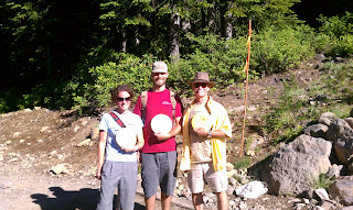
At the top of our chair lift ride we played frisbee golf - trying to throw frisbees into a disc golf basket. Dave is a pro at this. Amazingly we did not lose a single frisbee!
That is Rick tossing the frisbee, not doing ballet for Swan Lake.

And Happy Birthday to Kim who celebrated wildly in NYC today! All our love to you!!

Saturday, July 30, 2011

Mount Hood

Having lots of fun in Portland!

After wasting time with Sprint who said they had never seen such a problem before and could NOT retrieve any of my missing pics and could only hope it wouldn't occur again, we set off for more adventures at Mount Hood.

We took the chair lift up the mountain and then rode down on the alpine slide. Never had done this before - felt like I was on the luge! And it was a half mile long. Good thing Amy and Dave never let me see the guy with two bandaged arms and his face covered with road burn from flying off the luge! I only saw him as we left and heard his gruesome story since I couldn't help but ask what happened. He didn't remember much, but certainly heard about it from all the spectators!

That's Amy and Dave with Mount Hood in the background. Perfectly beautiful day with crystal clear views of the mountain (11,000 feet high- we were at 3,500 and Portland is at 65 feet elevation).

Friday, July 29, 2011

Arrival Portland!

Here we are! Now we get to visit Amy and Dave!
This was the biggest airport we have landed in.  Just after we climbed out of our tiny plane, an F18 took off! But you know, they treat us just as well as the big passenger planes and fighter planes.

Just a comment on our flying. Rick always has "flight plan waypoints", spots he is flying towards. But most times we fly VFR - visual flight rules. That way we can veer off course if we want to go see something.  Rick requests flight following from the controllers so they always know where we are and alert him to planes nearby or even when we got close to Mt Shasta. "Are you aware of the terrain and do you have it in view?"

Three Sisters and Mount Hood

Lots of scenic views today with snow capped mountains. The first are called Three Sisters and the second is of Mount Hood. This one is close to Portland and we have been snowshoeing on it.

Crater Lake

As you can see from the map on Rick's IPad (yes, this is his navigation source, etc for flying), Crater Lake is a nice round body of water at 6178 feet. It is in the caldera basin formed when Mt Mazama erupted about 7000 years ago. It is 5 miles in diameter and 1,932 feet deep - the deepest lake in the United States - and way bigger than Barringer Crater we saw in Arizona.

Mount McLoughlin

Mount McLaughlin is just 9495 feet high. If you look at the photo of it from a distance, you will see a " haze" line above it. That is us seeing the horizon from the altitude we are flying. Because the mountain is below this line, we know it is at a lower altitude than we are flying. Rick taught me this.

Mount Shasta

We started at about 1000 feet above sea level and climbed to 12,500, circling to gain height before nearing Mount Shasta, which is 14,162 feet high. Isn't it stunning? We flew just 8 miles from it. Below the mountain is Lake Shasta, a reservoir and recreational lake.

Before flying

There is a lot to do before jumping in the plane and taking off. One essential is getting gas. At a big airport they do it all for you. Here in Redding is the gas station. Rick puts in his credit card and pumps away - just like it was a car - only takes longer since the plane holds 38 gallons. We fly for 4 hours with that with time to spare. This was cheap gas - only $5.45 a gallon.

Then comes preflighting the plane - 7 pages of things to check. I have nothing better to do at this time, so today I took pictures to show my lovely hairdos while the propeller is on and the cockpit is still open.

At the other end the reverse happens, but that is easier for me. After sitting for almost 4 hours with not only a seat belt but also a double shoulder harness, and remembering to keep my feet away from the rudders, it takes a while to move my body! That is why I often sit on the top of my seat before climbing out of the plane!

Then I wander over to the FBO (fixed base operations), where they provide water, tea, coffee, cookies, popcorn, candy, or whatever, and of course restrooms. They are nice to pilots. But the best part is talking to the people.  Always an interesting story to be heard.
At least Vicki didn't lose her photos!

John, Vicki, Nate, Karen, Rick

Thursday, July 28, 2011

Cloud cover, San Francisco Bay, Mount Shasta

One pic shows you why we didn't fly the coast line- we wouldn't be able to see a thing!

Look carefully at the pic of San Francisco Bay. See the bridge in the middle? Just to the left of it is Alcatraz Island.

When we landed it was 106*.  I was sitting there staring at snow covered Mount Shasta. ( it is just left of the tail of the plane in front of ours).

Redding is like Richmond - 2 hours from the coast, near (much taller) mountains and (much clearer) lakes.

CA coast

This afternoon (Thursday) we flew to northern CA.  Rick intended for us to follow the coast line, but clouds were in the way. We did see a small part of the coast, but then flew up the valley. In the pic you can see the coastal range, the valley they farm in, and then more mountains.

LA

We spent the last two days visiting family in LA. As soon as we landed Rick took up his nephew, Max, then his niece, Alexa, for a ride in his plane.  They loved it. And I loved being on the ground and watching them!
We thoroughly enjoyed our visit - and I got to catch up on posting. Sat by the pool in the warm sun with a cold drink....
Wish I could show you some pics, but they are all gone, like the Painted Desert ones.

We drove to Pasadena last night to meet our friends from Florida.  So our plans we made in Santa Fe actually did happen!  John and Vicki's son Nate is what I call a space man. He is doing an internship working on level 4 lasers and there is no level five. Rick understod his job, but not me.

Page, Arizona to LA

On 7/26 we left Page with cloudy skies all around us.  The cloud cover was such that we'd never see the Grand Canyon.  So we actually headed east to avoid bad weather. But the good thing is we went through the Painted Desert. Amazing colors that were in the cliffs! Now the bad thing is these photos are gone. They show up as beds with a question mark. When we get to Portland tomorrow I am going to see if these are recoverable.

Retry

I would love for this video to come up on the blog, so I am resending it.
It is a panoramic view from the plane.

Mesa, Lake Powell, Landing

Just a random mesa we saw while flying along. And the photo was decent.

Another view of Lake Powell.  Definitely should be on a bucket list to rent a houseboat for a week and explore this lake surrounded by sheer cliff walls. It was man created when the dam was built and took years to fill in.  Now with the drought levels are pretty low, but the lake is still filled with boaters.

This is our view as we land.  Just thought you might want to see.

Stormy skies

As we approached Page, Arizona clouds began to build up. Makes for gorgeous photos as long as we aren't flying in them!
It never did rain on us - and the afternoon sky became totally clear for gong to Antelope Canyon, Horshoe Bend and Glen Canyon Dam (these photos have already been posted).

Approaching Lake Powell

We had to fly past this lone mountain to land at Page near Lake Powell. The black lines are the propellar blade. The propellar of course only has 2 blades, but it shows up as multiples in photos since it is spinning so fast. And I hope it keeps on spinning as we continue on! 
We are leaving LA this afternoon and going up the coast to Shelter Cove, CA.  I am days behind posting, so it was good to be at Rick's family's houses and catch up a bit!

Monument Valley

Monument Valley, Arizona

Whereas Canyon de Chelly was below the earth's surface, just a little further north is another wonder - Monument Valley - amazing red sandstone formations jutting up from the earth's surface.  They are various named buttes and mesas. I think the mesas are flat topped and the buttes are pointed or jagged.

Monument Valley

Wednesday, July 27, 2011

Canyon de Chelly

Canyon de Chelly

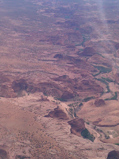
Canyon de Chelly is 131 square miles encompassing 3 major canyons. The land is owned by the Navajo people who still live and farm there.  The views of these canyons were breathtaking from the air. The sheer cliffs showed lines of color, the canyons were green with vegetation and all around was desert brown. We didn't see this from the ground, but we were nice and cool up in the air versus the desert heat!

NYTimes.com: Tiny Fists Hold Tight

The New York Times E-mail This
This page was sent to you by:  solana9@gmail.com

Message from sender:
If you look back at the mesquite rodeo blog. , this slide show is about the mutton busting I showed a video of. Big new event. Sign up your grandkids.

SPORTS   | July 26, 2011
Tiny Fists Hold Tight
Mutton busting, a kind of rodeo with children riding sheep, used to be the stuff or back corrals and halftime entertainment. But it is attracting a wider, more suburban audience and becoming a real competition.